In fall 2025, I joined the Cotsen Institute as a lecturer, teaching a course called Geographic Information Systems for Archaeology and Cultural Resource Management. The class focused on hands-on training in the analysis and visualization of archaeological spatial data using ESRI ArcGIS Pro. It also introduced students to the vast ecosystem of open-access, free, and low-cost geospatial data in online databases and web portals. Starting as a niche experimental method in the 1980s, geospatial archaeology (which includes software-based geographic information systems [GIS]; satellite, aerial, and terrestrial remote sensing; and high-density digital survey and measurement tools like lidar, photogrammetry, and laser scanning) has matured through several phases of exponential growth to become a well-established subfield (Ullah, I. I., Z. Clow, and J. Meling. 2024. Paradigm or Practice? Situating GIS in Contemporary Archaeological Method and Theory. Journal of Archaeological Method and Theory 31:1185–1231.). This has coincided with the expansion of geospatial science more broadly and the increasing availability of free, open-access geospatial data and resources. There has also been a vast proliferation of methods and tool kits for visualizing and analyzing data, as well as a deep reserve of expertise spread across online forums and communities to address nearly any geospatial problem.
A lot of my work as a landscape archaeologist has focused on finding geographic, environmental, and historical spatial data within this ecosystem and combining it in unique ways to address relevant archaeological questions. This approach was born out of necessity. I am an archaeologist working in the tropical environments of coastal eastern Africa, a region called the Swahili Coast (fig. 1), studying how communities there have adapted to environmental change and sociopolitical transformations. Over the past 2,000 years, coastal groups have created a vibrant, interconnected, urban mercantile society that has facilitated long-distance economic exchanges across the Indian Ocean in the process. Although this pivotal region links Africa to the world, the large-scale environmental and anthropogenic legacies of Swahili society remain relatively unexplored.
When I started work there during graduate school, I quickly realized that the transformative geospatial methods used in places like the Levant and the American Southwest were not so applicable. The Swahili Coast has a number of characteristics that limit the use of traditional methods in archaeological GIS and remote sensing: (1) a rainy tropical environment that produces dense vegetation and cloudy conditions, limiting site visibility in satellite imagery; (2) little monumental architecture or large-scale settlements built of permanent materials visible from space; (3) anthropogenic landscape modifications that are primarily vegetal rather than topographic (with very little topographic differentiation in general; most of the coast is a flat, low-lying plain); and (4) significant interdigitation of archaeological sites within modern towns, cities, and agricultural space. The challenges these characteristics pose for archaeologists interested in large-scale regional analysis with GIS and satellite remote sensing has meant that we are probably underestimating the scale and diversity of settlement in this region and the extent of landscape-scale anthropogenic transformations. This has undervalued the significance of this pivotal zone, which linked vast parts of East Africa to the Indian Ocean world during phases of early globalization, from antiquity to the nineteenth century.
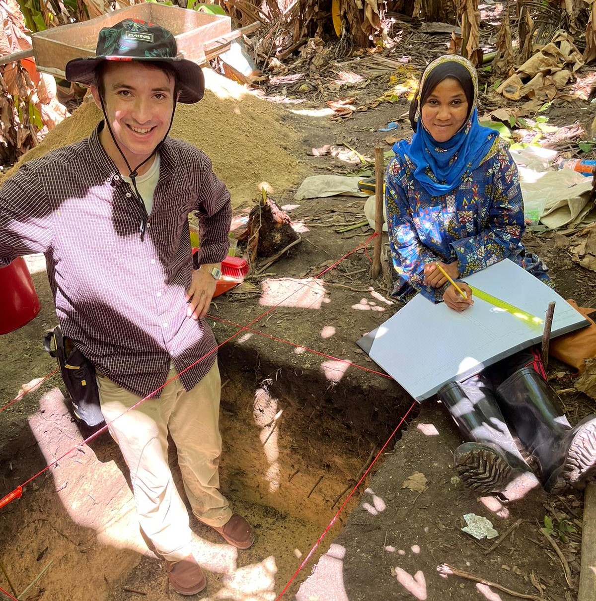
Researchers have noticed this limitation. A perennially cited paper is Fleisher and LaViolette’s article (Fleisher, J., and A. LaViolette. 1999. Elusive Wattle-and-Daub: Finding the Hidden Majority in the Archaeology of Swahili. Azania: Archaeological Research in Africa 34:87–108.) on detecting the “hidden majority” in Swahili contexts, an ethnoarchaeological study that tracked the decomposition of a modern Swahili wattle-and-daub house over only five years. Showing how quickly this form of common vernacular architecture degrades in the tropical climate and becomes almost invisible archaeologically, the authors argued that researchers were underestimating the extent and diversity of ancient Swahili villages, towns, and cities, given that most studies up until then had focused on only the small handful of monumental, stone-built ruins that occupied the elite centers of Swahili settlements. In the years since, researchers have increasingly investigated landscapes beyond the stone-built cores of Swahili cities, turning up evidence for craft, industry, long-distance trade, religious practice, maritime technologies, and the management of a broad spectrum of diverse resources from approximately the eighth century AD onward. Still, researchers have lacked the funding and labor to conduct fieldwork to identify these newly recognized settlement forms, since surveys often require intensive shovel-test pit grids and test units (fig. 2) to unearth deeply buried ancient wattle-and-daub architecture.
Despite the challenging characteristics of the eastern African coast, combined geospatial methods may help unearth the legacies of ancient Swahili settlement patterns, adaptations, and anthropogenic activities at a large regional scale. Since earning my PhD, I have experimented with techniques that combine environmental, historical, geographic, and topographic data in unique ways to better understand ancient Swahili landscape change.
For instance, in Zanzibar, Tanzania, I combined environmental data on hydrogeology and soil infiltration from a study on malaria transmission (Hardy, A., Z. Mageni, S. Dongus, et al. 2015. Mapping Hotspots of Malaria Transmission from Pre-existing Hydrology, Geology, and Geomorphology Data in the Pre-elimination Context of Zanzibar, United Republic of Tanzania. Parasites and Vectors 8.) with land use data from the European Space Agency’s Sentinel-2 WorldCover database; slope, aspect, and elevation data from the Shuttle Radar Topography Mission (SRTM); coral reef data from the Tanzania Sensitivity Atlas; soil type data from the Zanzibar Department of Rural and Urban Planning (Khamis, Z., R. Kalliola, and N. K.yhk… 2017. Geographical Characterization of the Zanzibar Coastal Zone and Its Management Perspectives. Ocean and Coastal Management 149:116–34.); rainfall data (Colbert, G., B. Wagner, and M. Pinther. 1987. Hydrogeological Map of Zanzibar. New York: United Nations.); and digitized features of a 1907 map of the island (Khan Bahadur, I. S. 1907. A Map of Zanzibar Island from Surveys Made by Imam Cherif Khan Bahadur. Gallica, https://gallica.bnf.fr/ark:/12148/btv1b52505995f.) that depicts streams, caves, wells, villages, and roads. Using a tool in QGIS called zonal statistics, I divided these environmental datasets into zones and weighted them by comparing them to the distribution of settlements on the 1907 map.
The result (Alders, W. 2023b. Open-Access Archaeological Predictive Modeling Using Zonal Statistics: A Case Study from Zanzibar, Tanzania. Journal of Computer Applications in Archaeology 6:117–42.) was a high-resolution model that accurately predicted the location of Zanzibar’s well-known precolonial towns, such as the port of Unguja Ukuu (eighth–tenth centuries AD), where researchers recently found a rock crystal seal ring inscribed with the Arabic word lillah (Sarathi, A., M. Kenoyer, and J. Walz. 2022. An Early Islamic Rock Crystal Amulet Seal from Unguja Ukuu, Zanzibar. Journal of African Archaeology 20:217–29.), and Kizimkazi, the site of eastern Africa’s oldest continuously used mosque, which has an inscription dating its construction to AD 1187 (Kleppe, E. J. 2001. Archaeological Investigations at Kizimkazi Dimbani. In Islam in East Africa: New Sources, edited by B. Scarcia Amoretti, pp. 361–84. Rome: Herder.). The model also accurately predicted the locations of smaller rural village sites that I had identified in surveys in 2019, the first discovery of rural agricultural villages (eleventh–fifteenth centuries AD) inland on the island, in zones that became plantations in the nineteenth century (Alders, W. 2023a. The Archaeology of Social Transformation in Rural Zanzibar, Tanzania, from the Eleventh Through Nineteenth Centuries CE. African Archaeological Review 40.). This method contributes to an understanding of the environmental affordances that structured long-term settlement change on the Swahili Coast and provides a baseline for heritage conservation and future prospection (fig. 3) using open-access software and freely available datasets.
Another way to investigate Swahili landscapes is through satellite remote sensing. With researchers from Columbia University and Syracuse University, I authored a paper exploring the ways that multispectral (perceiving more than the visible wavelengths of light), multitemporal satellite data (images of the same area taken over multiple seasons) can be used to investigate landscape palimpsests, define anthropogenic activities, and delineate field systems in tropical environments, where dense vegetation has traditionally limited visibility (Alders, W., D. S. Davis, and J. J. Haines. 2024. Archaeology in the Fourth Dimension: Studying Landscapes with Multitemporal PlanetScope Satellite Data. Journal of Archaeological Method and Theory 31.). For the last seven years, PlanetScope satellites have started near-daily imaging of parts of the earth’s surface, making multitemporal, multispectral, 3 m pixel imagery accessible to researchers. We applied composites of this imagery to landscapes across three Indian Ocean islands—Zanzibar, Mauritius, and Madagascar—and showed how the multispectral, multitemporal characteristics of this data can be used to draw out and quantify the subtle traces of anthropogenic modification to vegetated landscapes, which even lidar might fail to detect.
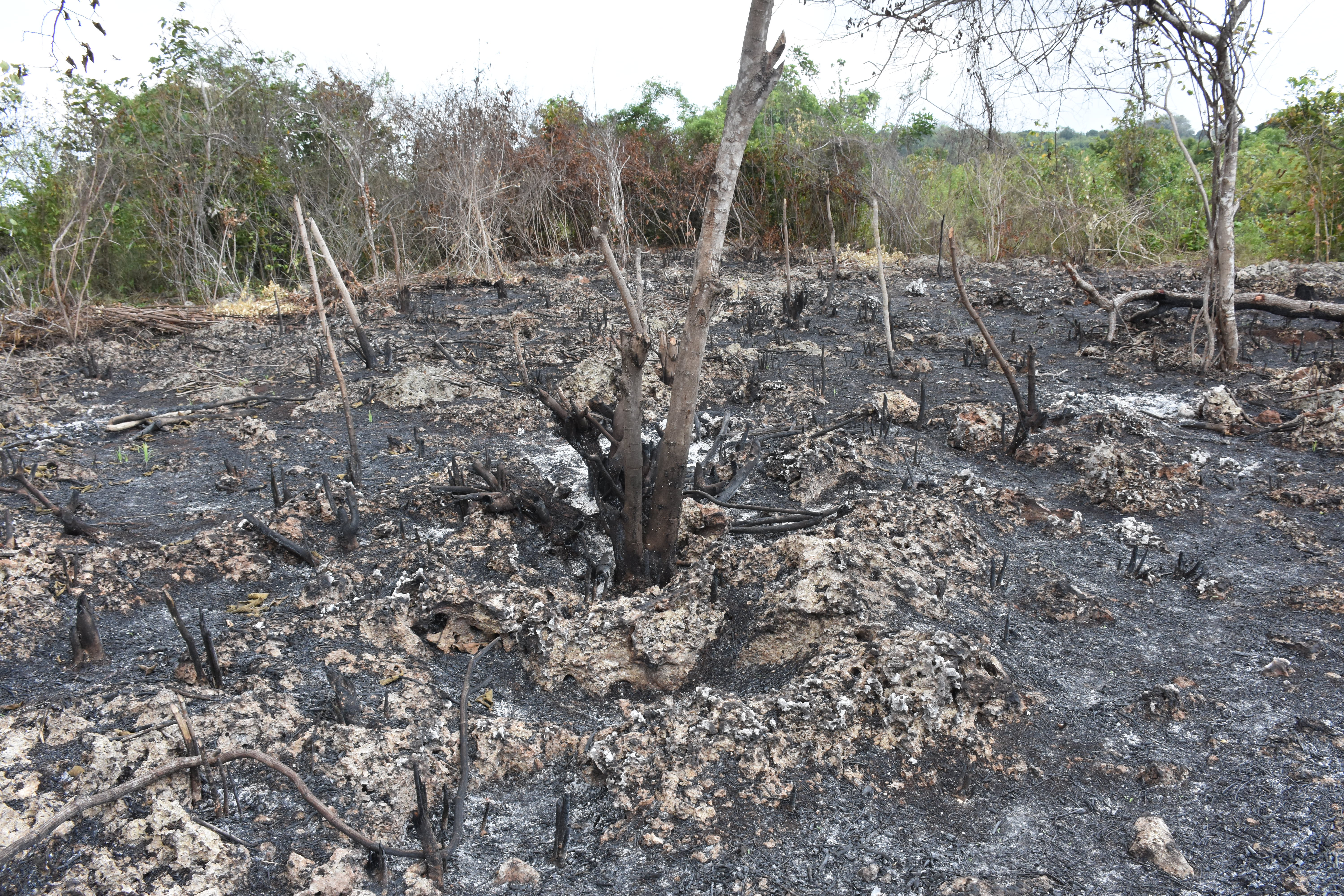
For instance, multispectral imagery drawn from multiple seasons can be used to distinguish and quantify the extent of shifting cultivation (figs. 4 and 5) and field construction in Zanzibar’s eastern region, a place long characterized as marginal, “natural,” and wild
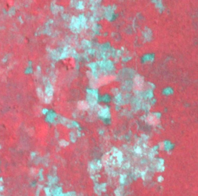
compared to the cultivated plantation zones of the west. This research, combined with surveys and oral history, has shed light on the way that Indigenous Swahili agricultural adaptations like kupiga makongo (cutting into limestone bedrock to conserve soils for planting) and swidden cultivation have shaped terrestrial landscapes for at least 1,000 years. I have also tried to address the problem of significant interdigitation between the Swahili archaeological record and modern urban land use by using similar multispectral satellite scenes to identify regions where rapid urban changes are obscuring, or threatening to obscure, areas of archaeological potential around the ancient core of Zanzibar Stone Town (Alders, W. 2024. Rural Settlement Dynamics in a Rapidly Urbanizing Landscape: Insights from Satellite Remote Sensing and Archaeological Field Surveys in Zanzibar, Tanzania. Journal of Field Archaeology 49:634–52.). These models helped me stratify and plan surveys in the city’s rural hinterland in 2023 and 2024, uncovering evidence for small rural nodes that were nevertheless connected to Indian Ocean trade networks as far back as the eighth century AD.
While most parts of the Swahili Coast do not exhibit large-scale landscape engineering in the form of earthworks, canals, or terracing, coordinated human activities still leave their mark on the vegetal record. Baobab trees (Adansonia digitata) are a particularly significant example (fig. 6). They are a crucial resource for thousands of communities across Africa today. All parts of the tree have important uses, for food, medicine, forage, cordage, cloth, mats, glue, soap, and fuel. Furthermore, many baobabs function as cultural landmarks and ritual venues. Baobab trees appear to be propagated through human activities and are strongly associated with archaeological sites. Thus their distribution may be an enduring and overlooked Anthropocene legacy within African landscapes. However, they are increasingly threatened by rapid urbanization and intensifying land use in some regions. Climate changes leading to droughts may also be impacting baobab populations, though this remains an ongoing debate (Venter, S. M., and E. T. F. Witkowski. 2024. Baobabs as Symbols of Resilience. Nature Plants 10:732–35.). Baobab resources are an important hedge against crop failure during droughts, so their loss exacerbates climate-induced insecurity, especially for rural communities.
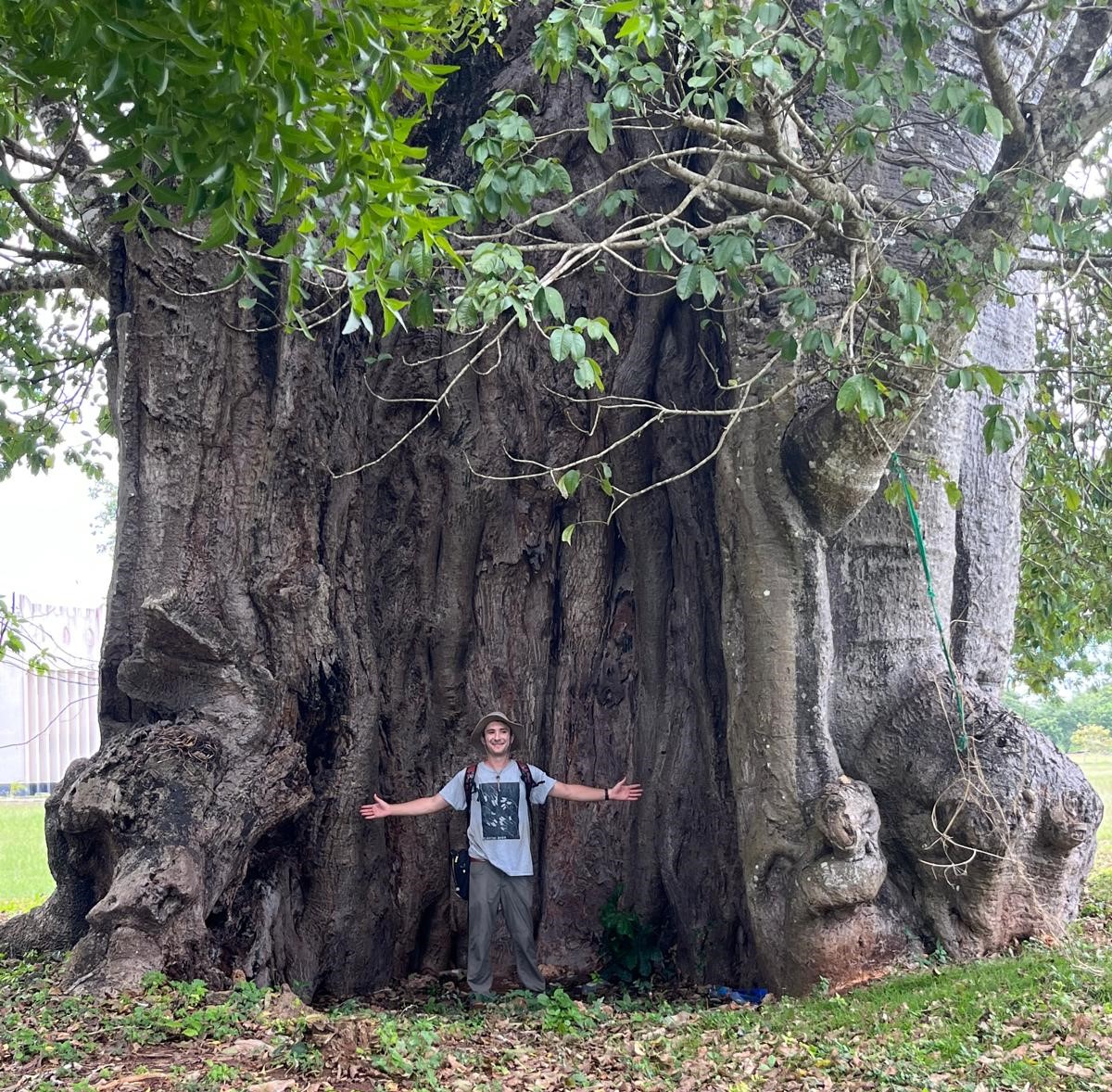
Efforts to conserve and understand human–baobab entanglements are stymied by a lack of large-scale, high-resolution data. To address this, I worked with Jonathan Lim (University of Arkansas) and Logan Brunner (University of Canterbury) to map baobab tree distributions in Zanzibar, using free, open-access, high-resolution drone imagery. Mapping baobabs can contribute to long-term archaeological understandings of Anthropocene entanglements while simultaneously aiding ecosystem conservation and sustainable community resource management. We published this research in the Journal of Archaeological Science (Alders, W., J. S. Lim, and L. Brunner. 2025. Detecting Baobab Trees (Adansonia digitata) in Drone Imagery and Evaluating Their Anthropogenic Legacy in Eastern Africa. Journal of Archaeological Science 180:106280.). You can also read about it on The Conversation.1
Now, as a codirector of the Dynamic Coasts and Landscapes of Resilience (CALOR) project in northern Tanzania, I am trying to bring all these methods together. Codirectors Ioana Dumitru (University of Sydney) and Elinaza Mjema (University of Dar Es Salaam [UDSM]) and I are combining satellite remote sensing, predictive modeling, soil science, archaeological survey and excavation, and community engagement to investigate the deep history of Swahili adaptations to climate extremes, monsoonal flooding, and natural disasters at the interface of the Pangani River system and the Indian Ocean over the last 2,000 years in northern Tanzania. The project explores the intersection of elite formation, collective action, and the management of environmental crises like monsoonal flooding, drought, and, notably, a tenth-century tsunami that buried the village of Kimu on the banks of the Pangani River (Mjema 2018).
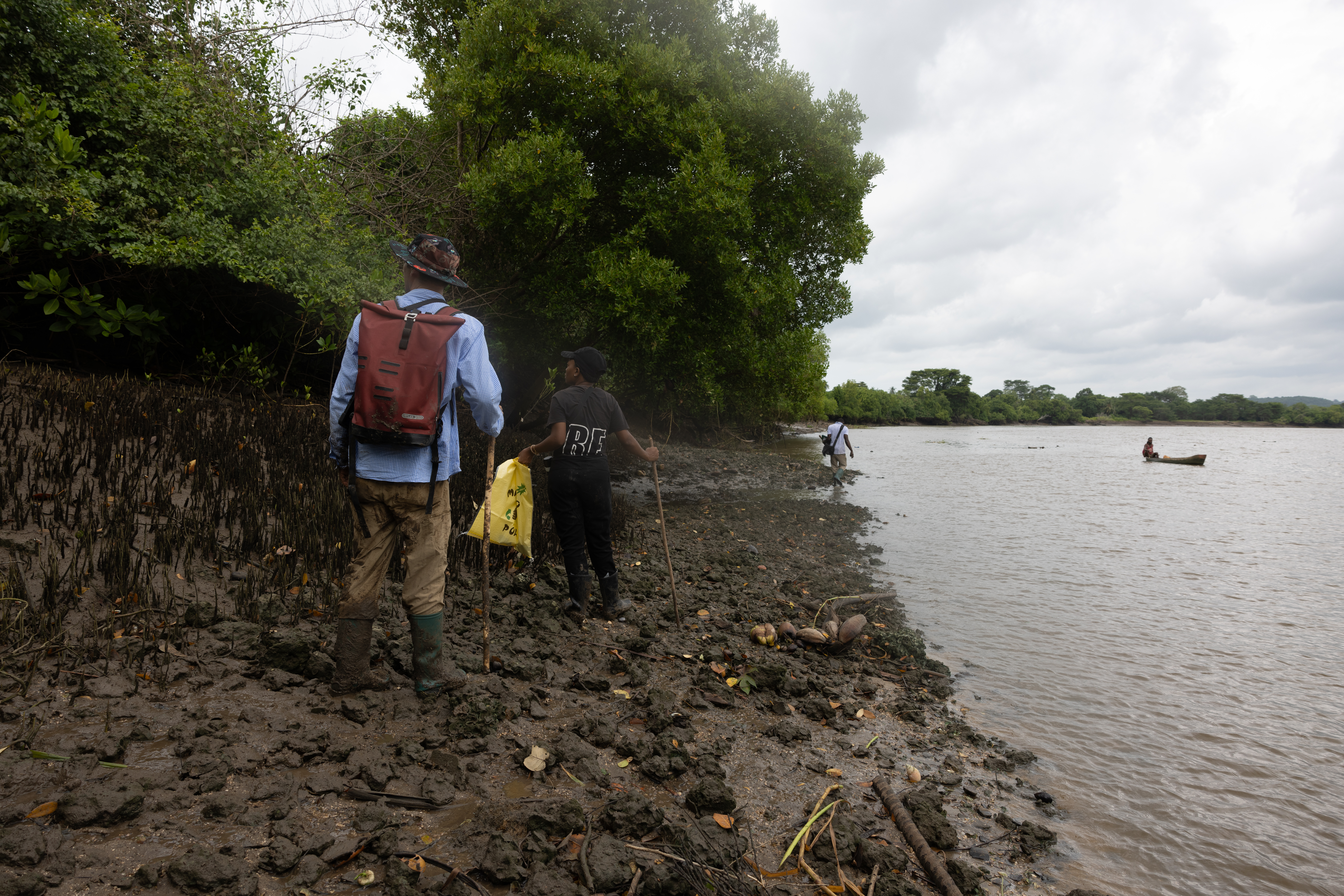
In 2024 we completed a systematic drone lidar survey, mapping the river mouth and bay across 80 ha with the help of Cotsen IDP alum Jacob Bongers. Our goals were to map existing archaeological sites in high resolution, detect new sites beneath dense vegetation, and model terrain to simulate flooding events related to monsoonal climate patterns and the tenth-century tsunami (fig. 7). With high-resolution terrain models derived from lidar, we will be able to explore water levels of extreme flood events to evaluate how they would have impacted other settlements upriver.
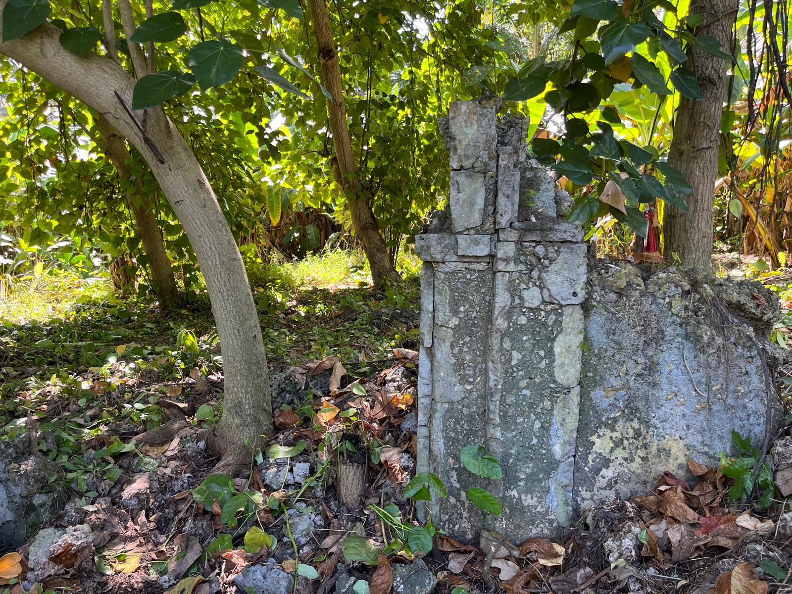
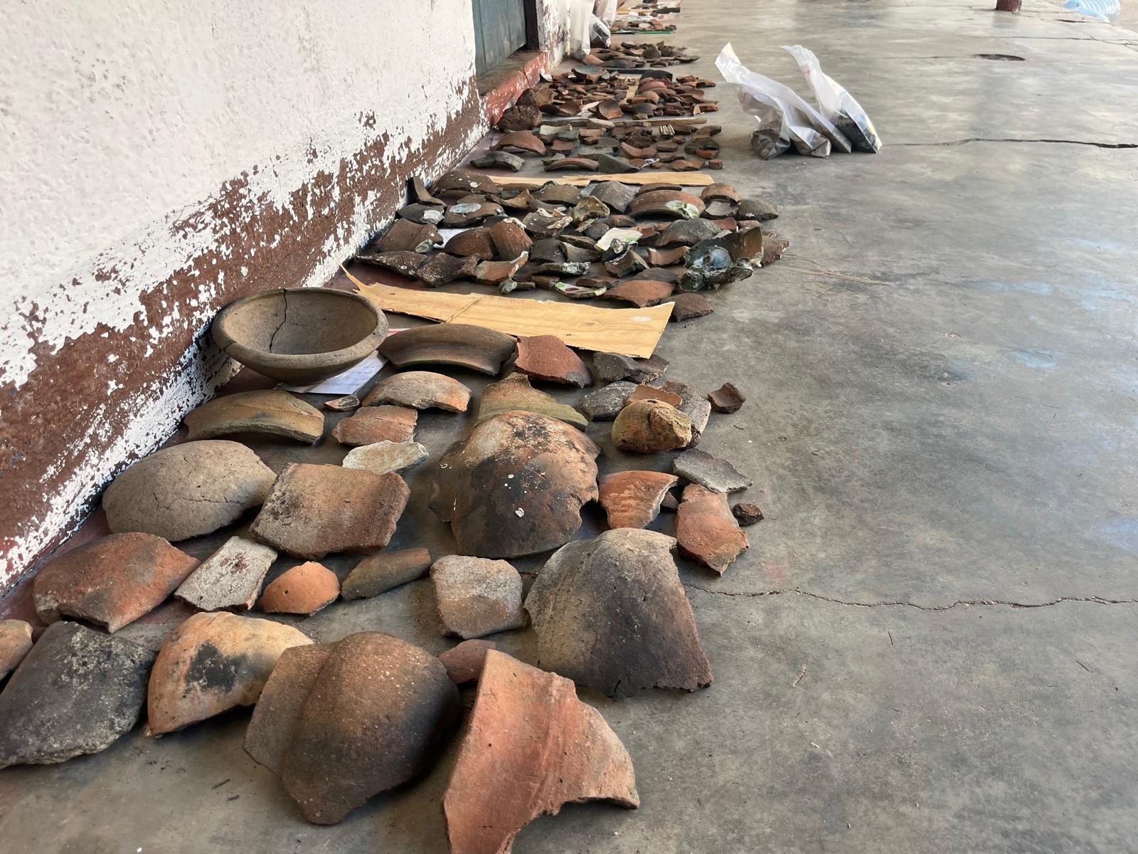
By comparing these models with archaeological data (fig.8) related to subsistence, craft, exchange, and settlement reorganization, it will be possible to evaluate how coastal communities adapted and built resilient frameworks in response to extreme weather events and climate change over the past two millennia. This will also provide data to aid in conserving agricultural land and heritage resources with communities in the present. Tanzania is disproportionately impacted by climate change, experiencing significant coastal flooding during the rainy season. Our work seeks to create ethical partnerships with stakeholders in Pangani to produce knowledge about climate resilience and disaster management from a long-term perspective.
Like the earlier predictive modeling in Zanzibar, CALOR is also leveraging the vast quantity and diversity of geospatial and environmental datasets that are now available for use. For instance, we are experimenting with bathymetry (GEBCO), sea level rise projections (IPCC AR6 and NASA Sea Level Change Portal), land use data (ESA WorldCover 10 m), geology (USGS and OneGeology), meteorological data (NOAA and ERA5 climate reanalysis), coral reef and kelp distributions (UNEP-WCMC and ReefBase), and terrestrial biodiversity models (Map of Life, GBIF) to inform our broader biogeographical understandings of Swahili human–environment interaction.
Keeping up with the lightning speed of growth in geospatial science is challenging for specialists, and even more so for archaeologists, who have to balance their engagement with other core concerns. But this is to be expected in a maturing field. As archaeologists first and foremost, we might never reach the expertise of a full-time GIS or remote sensing technician. But we do have synthesizing, organizational, and team-building skills that can help us leverage underutilized geospatial data and tool kits toward specific goals.
Wolfgang Alders received his PhD in anthropological archaeology from the University of California, Berkeley, in 2022. He was a National Science Foundation SBE Postdoctoral Fellow at the Center for Advanced Spatial Technologies at the University of Arkansas, Fayetteville, from 2022 to 2024 and a visiting research scholar at the Institute for the Study of the Ancient World in 2024–2025. After lecturing at UCLA in fall 2025, he began a postdoctoral position as a Marie Sklodowska-Curie European Fellow at the McDonald Institute for Archaeological Research at Cambridge University. You can find his personal website here: wolfalders.github.io. You can follow the CALOR project at calorarchaeology.com or on Instagram.
Notes
Bibliography
- Alders 2023a
- Alders, W. 2023a. The Archaeology of Social Transformation in Rural Zanzibar, Tanzania, from the Eleventh Through Nineteenth Centuries CE. African Archaeological Review 40.
- Alders 2023b
- Alders, W. 2023b. Open-Access Archaeological Predictive Modeling Using Zonal Statistics: A Case Study from Zanzibar, Tanzania. Journal of Computer Applications in Archaeology 6:117–42.
- Alders 2024
- Alders, W. 2024. Rural Settlement Dynamics in a Rapidly Urbanizing Landscape: Insights from Satellite Remote Sensing and Archaeological Field Surveys in Zanzibar, Tanzania. Journal of Field Archaeology 49:634–52.
- Alders et al. 2024
- Alders, W., D. S. Davis, and J. J. Haines. 2024. Archaeology in the Fourth Dimension: Studying Landscapes with Multitemporal PlanetScope Satellite Data. Journal of Archaeological Method and Theory 31.
- Alders et al. 2025
- Alders, W., J. S. Lim, and L. Brunner. 2025. Detecting Baobab Trees (Adansonia digitata) in Drone Imagery and Evaluating Their Anthropogenic Legacy in Eastern Africa. Journal of Archaeological Science 180:106280.
- Colbert et al. 1987
- Colbert, G., B. Wagner, and M. Pinther. 1987. Hydrogeological Map of Zanzibar. New York: United Nations.
- Fleisher and LaViolette 1999
- Fleisher, J., and A. LaViolette. 1999. Elusive Wattle-and-Daub: Finding the Hidden Majority in the Archaeology of Swahili. Azania: Archaeological Research in Africa 34:87–108.
- Hardy et al. 2015
- Hardy, A., Z. Mageni, S. Dongus, et al. 2015. Mapping Hotspots of Malaria Transmission from Pre-existing Hydrology, Geology, and Geomorphology Data in the Pre-elimination Context of Zanzibar, United Republic of Tanzania. Parasites and Vectors 8.
- Khamis et al. 2017
- Khamis, Z., R. Kalliola, and N. K.yhk… 2017. Geographical Characterization of the Zanzibar Coastal Zone and Its Management Perspectives. Ocean and Coastal Management 149:116–34.
- Khan Bahadur 1907
- Khan Bahadur, I. S. 1907. A Map of Zanzibar Island from Surveys Made by Imam Cherif Khan Bahadur. Gallica, https://gallica.bnf.fr/ark:/12148/btv1b52505995f.
- Kleppe 2001
- Kleppe, E. J. 2001. Archaeological Investigations at Kizimkazi Dimbani. In Islam in East Africa: New Sources, edited by B. Scarcia Amoretti, pp. 361–84. Rome: Herder.
- Sarathi et al. 2022
- Sarathi, A., M. Kenoyer, and J. Walz. 2022. An Early Islamic Rock Crystal Amulet Seal from Unguja Ukuu, Zanzibar. Journal of African Archaeology 20:217–29.
- Ullah et al. 2024
- Ullah, I. I., Z. Clow, and J. Meling. 2024. Paradigm or Practice? Situating GIS in Contemporary Archaeological Method and Theory. Journal of Archaeological Method and Theory 31:1185–1231.
- Venter and Witkowski 2024
- Venter, S. M., and E. T. F. Witkowski. 2024. Baobabs as Symbols of Resilience. Nature Plants 10:732–35.