GIS methods
In July 2022, the team arrived in Tamban port with Father Eric, the Bicol Archaeological Project’s (BAP) primary community contact and a representative of the Catholic Church, and Earl Hernandez, a Bikolano and fellow BAP researcher. We did a survey of the town and took GPS points for a large concrete slab that was a component of the old rail platform and for a concrete foundation of a crane that was used to load and unload logs. Both structures were nestled between and beneath people’s homes and businesses. From an interview with Annie Cabral, captain of the barangay—head of the smallest political unit in the Philippines—we learned about the status of land reclamation in Tamban and subsequent erosion on the opposite bank, as well as the ongoing challenges facing development efforts in the barangay: expanding settlement, erosion, and flooding. We also learned that the rail line used to run along the river and bring in lumber from Lagonoy. Tebbe’s (1967) account corroborates the existence of a port at this location, near the first Cadwallader-Gibson logging camp, Camp Isarog, so named for its views of Mount Isarog. We conducted one drone flight over Tamban. The lidar data were not as clean as we would have liked due to the high humidity and visible water vapor in the air, but this scan still produced a detailed elevation model.
It is important to rely on local people’s definition of flooding, because the risk associated with seasonally rising waters can be subjective. Cabral indicated the elevation below which flood waters put homes and businesses at risk. The extent of flood risk became clearer when we combined this community-sourced flood elevation with the elevation model derived from the lidar scan. Using aerial photos and the orthomosaic of the town in ArcGIS, we calculated the total area of the town that included modern buildings and then the percentage of that area lying below the elevation at risk of flooding. We found that the flood plain extends to endanger 28.5% of the occupied area of Tamban.
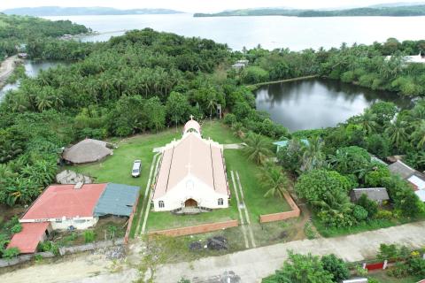
Two days after our arrival in Tamban, Hernandez, Father Eric, and Meyer-Lorey visited Tandoc. We met up with local Catholic priest Father Serafin Amaro and conducted a ground survey, taking 32 GPS points of concrete and iron structures that belonged to Jacob Chetvernia’s Woodworks plywood operation. We circled the two artificial freshwater lakes built by the plywood company and examined the pier, which once was a wooden rail platform and is now a concrete promontory.

