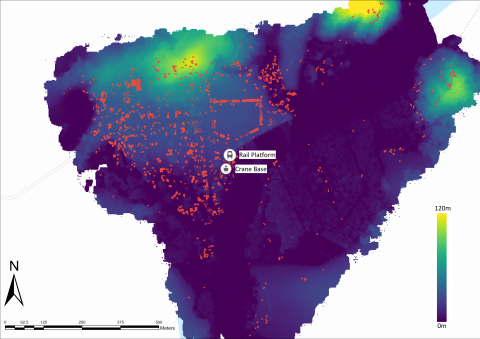
Figure 8
Lidar elevation model of Tamban port with points classified as structures overlayed in red; 28.5% of the occupied area in Tamban sits at an elevation at high risk of flooding.
Item record
Publication
Manifest Destiny in Southeast Asia: Archaeology of American Colonial Industry in the Philippines, 1898–1987
Data type
Creator
Collection
Geographic terms

