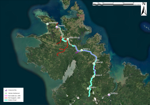
Figure 6
Modern satellite map showing an overlay of historical extent of the rail lines mapped by Abadilla (circa 1935) in red; the rail lines visible in aerial photography (January 4, 1945) are in purple. Almost the entire extent has been directly paved over to form the modern road (shown in teal).
Item record
Publication
Manifest Destiny in Southeast Asia: Archaeology of American Colonial Industry in the Philippines, 1898–1987
Data type
Creator
Collection
Geographic terms

